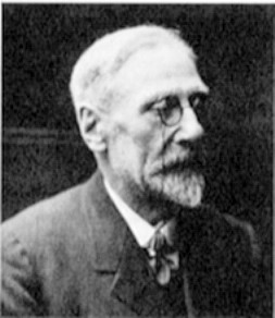
The name that springs instantly to mind is Alfred Watkins (1855-1935). The story of his “discovery” of an ancient system of lines crossing the British landscape is well known to present-day ley line afficionados and to the small number of archaeologists who have ever looked into them. I quote his summary of the system on the main site, but it is worth repeating here:
…imagine a fairy chain stretched from mountain peak to mountain peak, as far as the eye could reach, and paid out until it touched the “high places” of the earth at a number of ridges, banks, and knowls. Then visualize a mound, circular earthwork, or clump of trees, planted on these high points, and in low points in the valley other mounds ringed round with water to be seen from a distance. Then great standing stones brought to mark the way at intervals, and on a bank leading up to a mountain ridge or down to a ford the track cut deep so as to form a guiding notch on the skyline as you come up. In a bwlch or mountain pass the road cut deeply at the highest place straight through the ridge to show as a notch afar off. Here and there, at two ends of the way, a beacon fire used to lay out the track. With ponds dug on the line, or streams banked up into “flashes” to form reflecting points on the beacon track so that it might be checked when at least once a year the beacon was fired on the traditional day. All these works exactly on the sighting line. The wayfarer’s instructions are still deeply rooted in the peasant mind to-day, when he tells you—quite wrongly now—“You just keep straight on”.
According to a later account, all this came to him “in a flash” on 21 June 1921 during a visit to Blackwardine; according to his son Allen, this happened while poring over a map. A variation on the ‘origin myth’ quoted by John Michell holds that the revelation happened whilst out riding in the hills near Bredwardine in 1920, observing the Herefordshire landscape he loved. It is unclear why there are two different versions of the story; Tom Williamson and Liz Bellamy note wryly in their excellent Ley Lines in Question (Tadworth: World’s Work, 1983) that John Michell’s version reflects how “ley hunters would like to think it happened”.
What is strange is that few people ever bother to read what Watkins himself says in the Introduction to his first publication on the subject, Early British Trackways, in 1922. There, he says:
I knew nothing on June 30th last of what I now communicate, and had no theories. A visit to Blackwardine led me to note on the map a straight line starting from Croft Ambury, lying on parts of Croft Lane past the Broad, over hill points, through Blackwardine, over Risbury Camp, and through the high ground at Stretton Grandison, where I surmise a Roman station. I followed up the clue of sighting from hill top, unhampered by other theories, found it yielding astounding results in all districts, the straight lines to my amazement passing over and over again through the same class of objects, which I soon found to be (or to have been) practical sighting points.
So, what Watkin noted was an alignment of sites on a map; he may have seen this while planning his journey to Blackwardine, during the journey or upon arrival at his destination. At any rate, we can put the minor controversy of the exact details of his “discovery” to rest.
But to what extent was this his discovery? Wikipedia is in no doubt: “The concept of “ley lines” originated with Alfred Watkins in his books Early British Trackways and The Old Straight Track, though Watkins also drew on earlier ideas about alignments; in particular he cited the work of the English astronomer Norman Lockyer, who argued that ancient alignments might be oriented to sunrise and sunset at solstices.”. Much as I am criticised by commentors here for quoting Wikipedia, it has become one of the most widely used sources of information in the world today and is often the first (and, indeed, only) reference source to which people will resort. It also tends to reflect received wisdom (even when that wisdom is wrong). And that is what seems to be the case with its entry for ley lines.
Back to Joseph Houghton Spencer
Joseph Houghton Spencer was a nineteenth-century antiquary, who published papers on Castle Neroche, Taunton Castle and other sites of interest in the Taunton area. He was an architect by profession, restoring the church at Goathurst (Somerset) in 1884 and designing a number of others. He was based, unsurprisingly, in Taunton (Somerset, England). His antiquarian interests are best represented through his transcripts of historic parish registers, which continue to be used today.
He came to my attention thanks to a member of my local archaeological society, who knows my interest in Bad Archaeology. During some research this member was undertaking on medieval routes in north-eastern Hertfordshire, he came a cross a paper published in The Antiquary Volume XIX (1889, pages 94-101), titled Ancient trackways in England (a number of sources incorrectly give the volume of The Antiquary as XX).

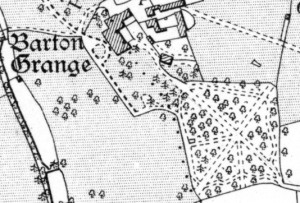
The paper starts with an account of “a broad pathway, about 600 feet long, which is crossed by another of the same length, thus forming a Greek cross” in woodland at Barton Grange in Taunton. From this, he leaps to a number of conclusions that go way beyond the evidence: noting that the Grange “is said to have been the summer residence of the Prior of Taunton” and that these paths were known as “the “Monks’ Walk”” in the 1880s, he concludes that they were part of the putatively monastic layout. He then proceeds to extend the centre lines of these paths to tracks and monuments outside Barton Grange Park and surmises that to avoid blocking the view from the central crossing of the two main paths, “openings were left in the walls when the building was first projected on the line of sight”. In other words, he is suggesting that the layout of the paths pre-dates the monastic foundation.
Next, astronomical alignments are brought into play: one line “points directly towards the position on the horizon where the sun sets on June 21”. He also brings into play various prehistoric earthworks, including hillforts and round barrows, prominent hills and “suggestive names”, such as Cold Harbour, Pipe House, Horn Ash, Three Ashes and Stony Knap, without explaining what is “suggestive” about them. One line is extended out to the south coast at the Isle of Portland and in the opposite direction across the Bristol Channel to south-west Wales and further, across the Irish Sea and into the Atlantic Ocean “at or near Killala Bay”. This makes the supposed St Michael’s Ley seem positively parochial! The other principal line is also extended, using Roman roads as well as the usual hills and earthworks together with “Black’s “Atlas”” to the North Sea, “nearly in a line with Spurn Head”. He then devises lines parallel to these, passing through Castle Neroche.
What does he make of all this?
Having recorded these observations, I venture to suggest the following explanation:
The general design of the works seems to be a central line of long distance signals, with more frequent posts to the right and left connecting the natural harbours at the mouths of the Wey, Axe, Otter, Exe, Teign, Parret, Brue, Avon, Medway, Thames, and Humber; also St. Gennys, near Bude Haven, an important position on the Cornish coast, and Minehead.
These direct signal-line stations, though no doubt connected with each other by trackways, would not always afford the best lines for the principal roadways; and we find that the early ridgeways, so far as they have been traced, connected nearly all the foregoing points; but, owing to the physical and other difficulties, not in straight lines. There seem to be indications of other parallel arrangements of fortified posts and beacons, and it is probable that, upon further research, it will be found that these north-west and north-east lines are preserved as guiding ones throughout the entire district, which was under the control of these early, perhaps Phœnician, far-seeing engineers.
This is all very similar to Watkins’s system, but without the insistence that the hypothetical tracks need to follow precisely the alignment marked by various monuments and landscape features.
Like Watkins, Houghton Spencer seems to have regarded the system as surviving through the medium of christianised pagan sites. He hypothesised that the system fell into disrepair “until the dissolution of the religious houses by Henry VIII. Then the idea was lost, and, consequently, no regard was paid in building, from the seventeenth century downwards, to the far-reaching lines of the cross”. Unlike Watkins, who saw medieval church builders as merely building on ancient markers, Houghton Spencer believed that the medieval church retained a knowledge of this system, although “in the hands of laymen it has been carefully preserved for more than three centuries, and by no one more conservatively than the present owner… to whom I would venture to suggest that a careful excavation at the cross-centre would probably be attended with interesting results”. Also unlike Watkins, everything in the system hinges on these crossing paths at Barton Grange, described as “[t]his cruciform centre of, perhaps, both civil and religious government”.
The paper concludes with a typical late nineteenth century farrago of quite unscientific linguistic speculation. Using Greek and Hebrew to seek etymologies for English placenames provided Victorian antiquaries with opportunities to show off their learning, but carry little weight today except among misguided amateurs. Once again, though, Watkins was equally keen on “suggestive names” to determine the passage of a ley line, where no physical marker could be found.

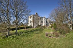
Of course, to a twenty-first century archaeologist, these broad pathways present no problem. They are typical of eighteenth-century gardens created by landscape gardeners to enhance the country estates of the wealthy. Barton Court is a probably sixteenth-century house, now much altered; nineteenth-century Ordnance Survey maps show the layout of the woodland walks and they look absolutely typical of this type of garden feature. The two principal arms of the cross run to the corners of the roughly rectangular woodland and appear to survive, albeit overgrown, to the present day. We can discount any great scheme of alignments, spiritual and political centre of ancient Britain, routes to the significant harbours of Britain and so on.
Watkins or Houghton Spencer?
So, who did ‘discover’ (recte ‘invent’) ley lines? The term ley belongs to Watkins, completely misunderstanding Old English lēah (principally meaning ‘woodland clearing’ in placenames). The ley line system as widely (mis)understood today is his concept, modified by the New Age speculations of writers such as John Michell. But was Watkins drawing on this paper by Joseph Houghton Spencer? He does not mention it in any of his published works. The Woolhope Club, the antiquarian and natural history society of which Watkins was a prominent member, did not subscribe to The Antiquary, so he will not have seen Houghton Spencer’s thirty-year-old paper in the club library. Although the two ideas are so close in conception, there seems to be little cause to accuse Alfred Watkins of plagiarism. The idea of ancient trackways of any age—prehistoric, Roman or medieval—or any character—military ways, saltways, trade routes—was part of the general culture of Late Victorian and early twentieth-century antiquarian speculation. A more rigorous approach to studying tracks has never really been at the forefront of archaeological research: some of the worst “research” was been carried out on Roman roads (for instance, The Viatores Roman roads in the south-east Midlands, while well intentioned, is a triumph of enthusiasm over rigour).
On a final note, I’d like to correct a misconception in the Wikipedia entry for Alfred Watkins, quoted above. According to the editors, “[a]rchaeologists in general do not accept Watkins’ ideas on leys. At first they regarded the ancient Britons as too primitive to have devised such an arrangement, but this is no longer the argument used against the existence of leys”. That is just plain wrong, although it is the sort of accusation flung at archaeologists by ley hunters. As Tom Williamson and Liz Bellamy point out, academics largely ignored it, even if O G S Crawford did regard Watkins as a crank, his reason for notoriously refusing an advertisement for The Old Straight Track in Antiquity. There was a general perception that prehistoric people had little use for such a complex system. The prevailing (but incorrect) view of Neolithic Britain as a heavily forested landscape, save for a few pioneering farms, made the establishment of the network a virtual impossibility in the view of prehistorians. It was left to amateur enthusiasts to take up Watkins’s idea. No, the problem that academics had with the concept of ley lines was that Watkins, like Houghton Spencer before him, failed to provide any evidence for the antiquity of the system. Despite Wikipedia, ley lines do not exist!


This was a fun read, after living in the Taunton-Minehead-ExMoor area it was fun to find out that the craziness around Ley lines started there. It makes me wonder how they came to this conclusion as you rightly point out it is not the most forgiving area for straight lines.
LikeLike
The ‘non plus ultra’ of Lay lines-like alignments appears in the book The Timekeepers of Ancient earth found here : earthsunexposure.com
LikeLike
Reblogged this on Nina's Soap Bubble Box.
LikeLike
I have been researching the ley lines here in Scotland for over 30 years and can state conclusively that leys do exist – the USA has ALL of its capital cities in straight lines from extinct volcanoes in outlying islands My hometown in Perthshire has its three main streets in the form of a right angled triangle in line with three volcanic plugs. See my website leylines.webplus.net for more information
LikeLike
https://polldaddy.com/js/rating/rating.jsI have been researching the ley line system here in Scotland for decades. around my home town of Crieff in Perthshire I have discovered around 80 leys from ancient sites like standing stones and circles in alignment with the streets in this town. Strangely, the country roads surrounding Crieff are in zig zags connected with bends. These are also connected with ancient sites. Even more strange is the “Pow Stream” – irrigation ditches built by the monks which are also in alignment. Even several “glacial erratics” – boulders once thought to have been left by the ice age are in alignment. The whole area has been skilfully designed for almost 5,000 years. One of the purposes seems to have been to keep the living separate from the spirits of their ancestors. Have a look at my websitre and click on the yellow button at top right of Index page marked “Lyn, Sacred Strathearn”
LikeLike